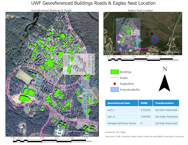
Module 6 Lab Georeferencing, Editing, & 3D
In the first part of Lab 6 we learned about Georeferencing. In Georeferencing you take arial images and match them up to a base map in Arc GIS Pro. You use a function called Georeference which allows you to select points on the basemap as well as the image in order to align them on top of one another. I can see this particular tool being very useful. In the second part of Lab 6 we learned how to take the first map we made with the Georeference tool and turn it into a 3D image. This was not a required task, but I was very interested to see exactly how it works. Overall, it was very interesting to take what was a 2D object and turn it into a 3D object. I look forward to messing around with this function more in the future.


Comments
Post a Comment